
![mhjeong [at] myeonghun [dot] org](image/mail.gif)
News
Best Teacher Award, 02/2024:
I received the Best Teacher Award for 2023 from Chosun University.

International Colloquium at University Technology Malaysia, 01/2024:
Our group participated in the international colloquium at the University Technology Malaysia(UTM). Seungbae Jeon and Joo-Wan Kim presented their ongoing works.

Presentation at KSIS Fall Conference, 12/2023: Our group members, Seungbae Jeon and Min Seong Lee, presented their papers at the KSIS Fall Conference. Seungbae presented "Marine Monitoring based on Satellite Images and AIS Data Using Deep Learning Models," and Min Seong introduced "Urban decline analysis based on hotspot analysis using floating population."
Presentation at the KSCE 2023 Convention, 11/2023: Our group member, Taeyoung Lee, presented his ongoing work, "Enhancing the Performance of Machine Learning Model based on Data Augmentation using Generative Adversarial Network," at the KSCE 2023 Convention.
Congratulation on the new job at the National Geographic Information Institute, 10/2023: Our group member, Taeyoung Lee, received a job offer from National Geographic Information Institute. Well done on the new career. All your hard work has finally paid off.
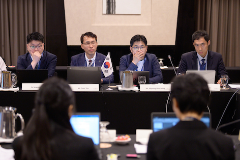
Participation in the 3rd EAHC MSDIWG Meeting, 09/2023: I participated in the 3rd East Asia Hydrographic Commission(EAHC) Marine Spatial Data Infrastructure Working Group(MSDIWG) Meeting in Hanoi, Vietnam. I reported on IHO MSDIWG and EAHC MSDIWG as the delegate of the Republic of Korea.
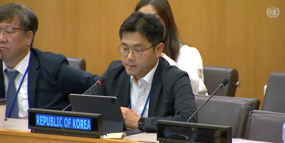
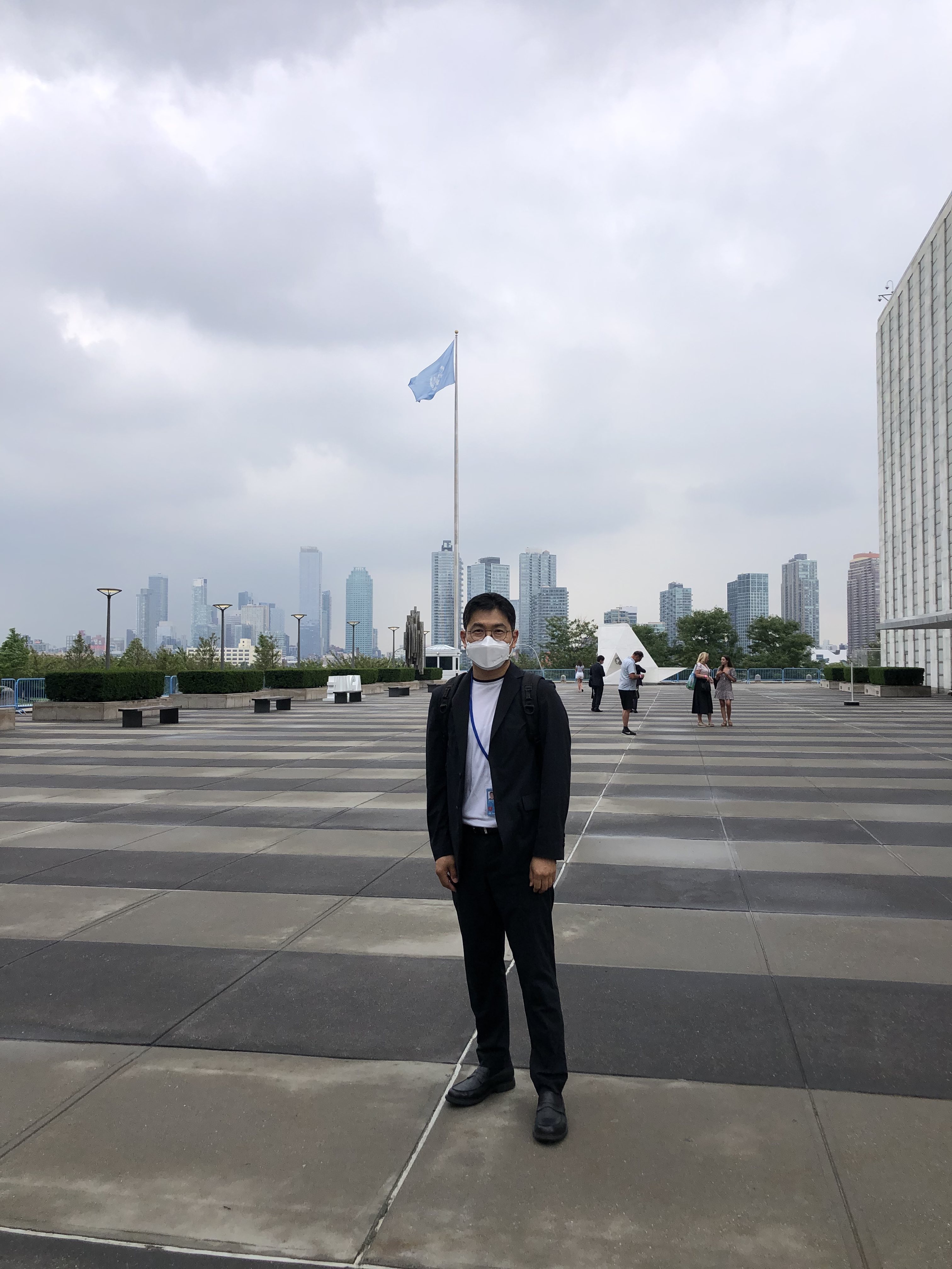
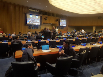
Participation in the 13th UNGGIM as the delegate of the Republic of Korea, 08/2023:
I participated in the 13th session of the United Nations Committee of Experts on Global Geospatial Information Management (UN-GGIM) as the delegate of the Republic of Korea. I have mainly been involved in the Working Group on Marine Geospatial Information to support Korea Hydrographic and Oceanographic Agency.
Summer Training Program for Career Guidance Teachers, 07/2023: Career guidance teachers in high school visited our university to participate in the major experience at the summer training program. I had a valuable opportunity to introduce Civil Engineering to career guidance teachers in this program.
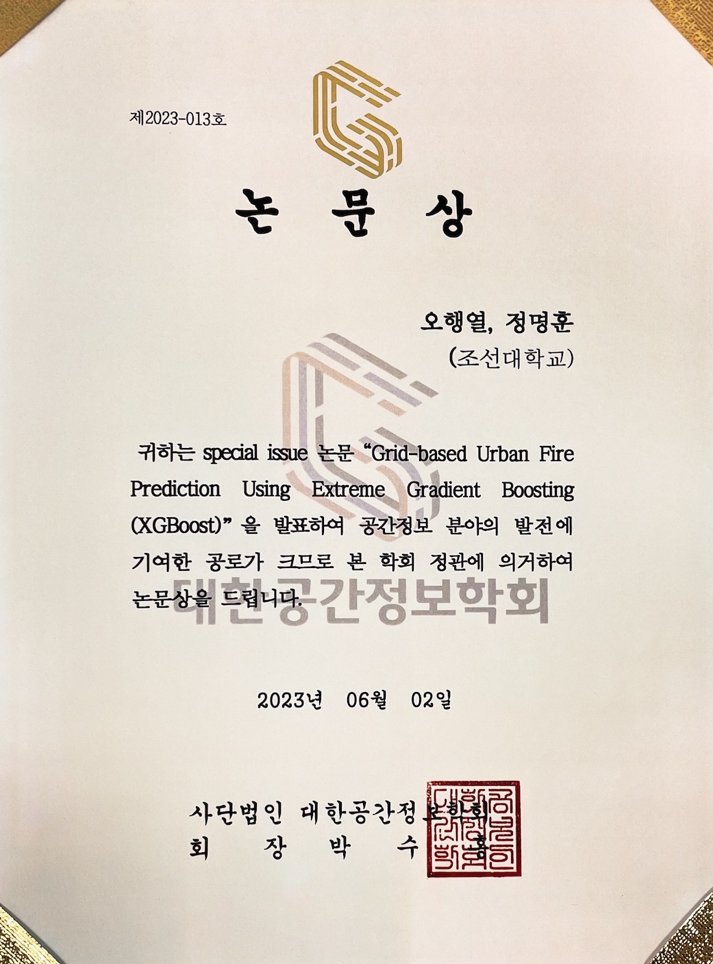
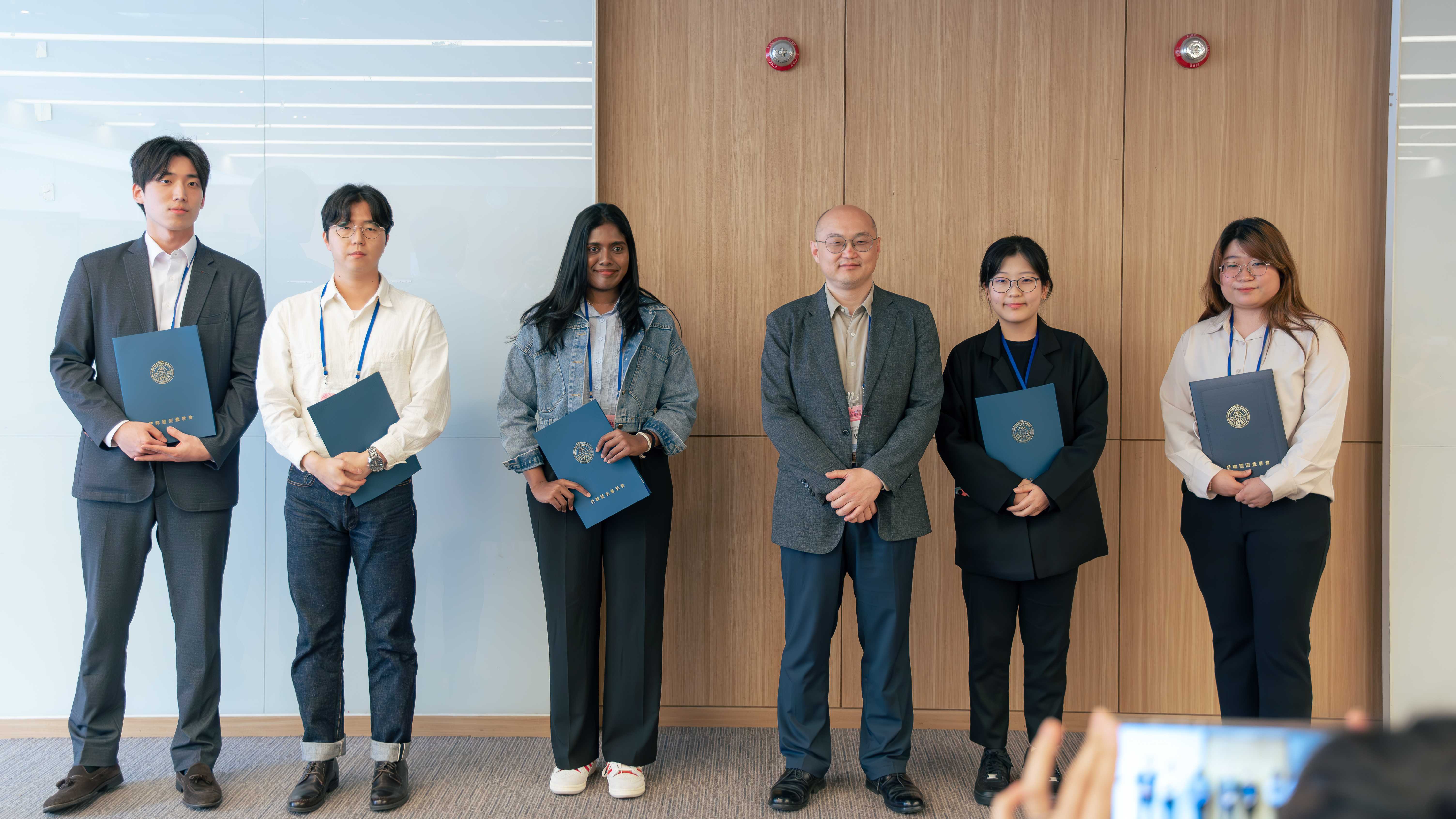
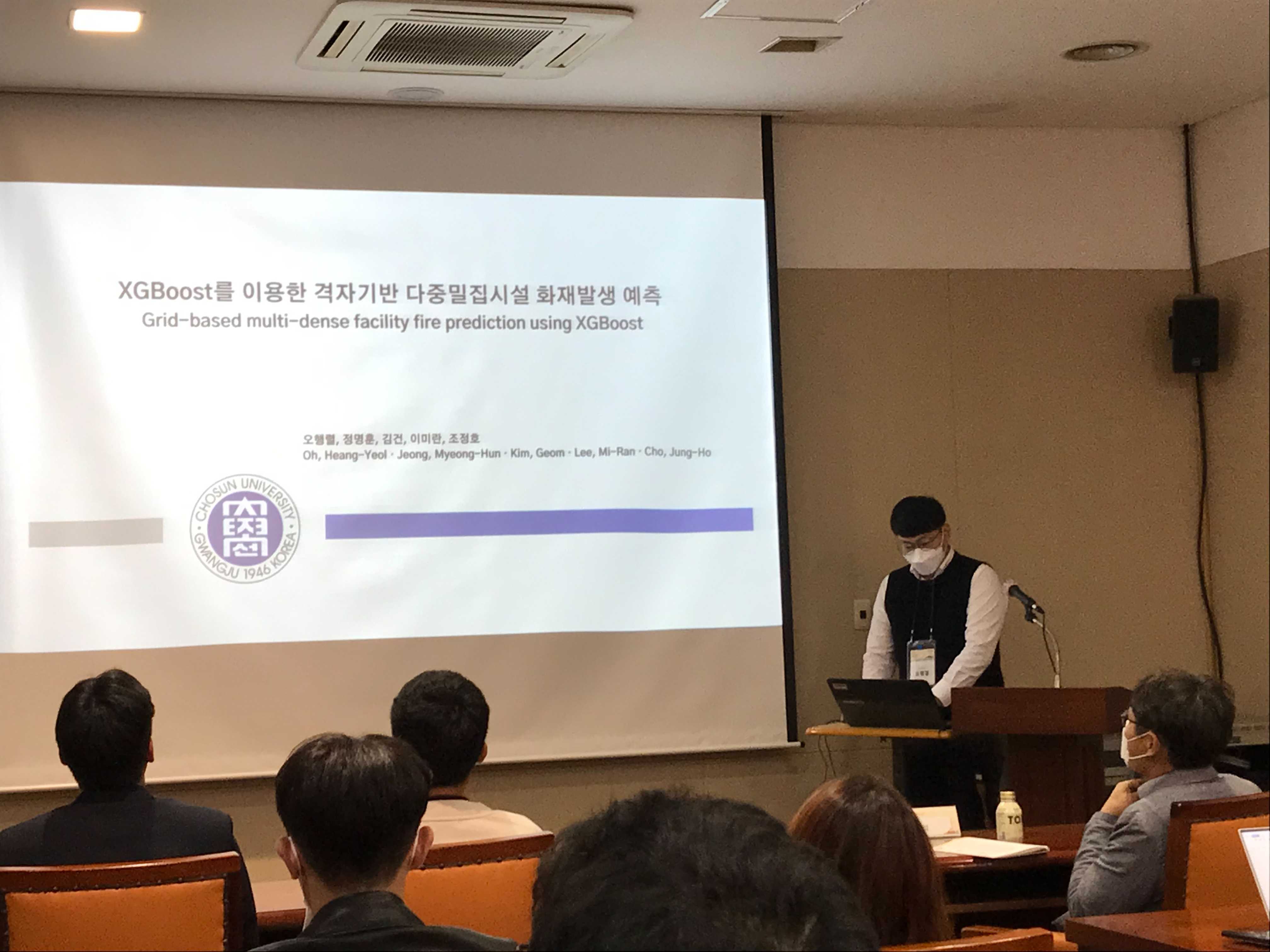
Best paper award from KSIS Journal, 06/2023:
Our group member, Haengyoel Oh, received the best paper award from Korea Spatial Information Society Journal. In additon, Seungbae Jeon presented his ongoing research at the 2023 Korea Spatial Information Society Spring Conference, "A Proposal for Loss Function for Performance Improvement of Deep Learning-based Vessel Trajectory Prediction Model".
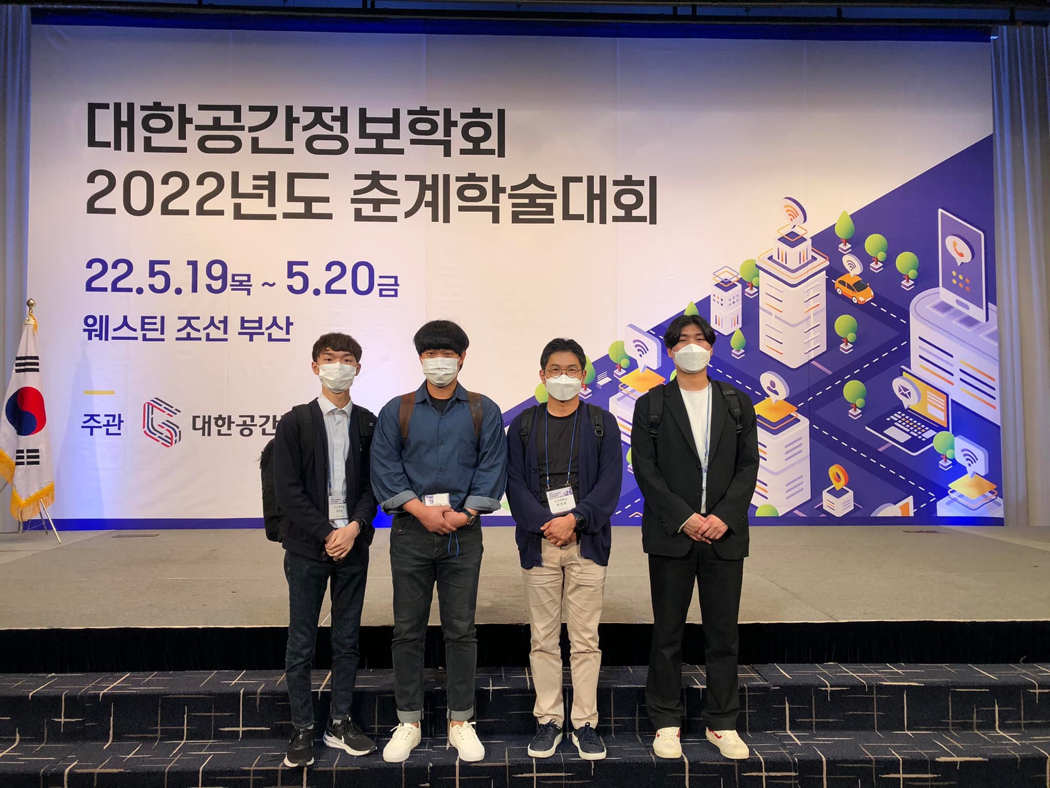
Best paper award at the 2023 KSGPC conference, 05/2023:
Our group member, Taeyoung Lee, received the best paper award at the 2023 KSGPC (Korea Society of Surveying, Geodesy, Photogrammetry, and Cartography) conference. His research focuses on enhancing the object detection algorithm performance for real-time marine debris detection.
AAG 2023 Annual Meeting, 04/2023: I attended the AAG 2023 Annual Meeting in Denver, USA. Our group member, Seungbae Jeon, presented his ongoing research, "Short-term Traffic Speed Prediction of Urban Road Networks using the Integration of Spatio-Temporal Graph Convolutional Networks and Convolutional Neural Networks."
14th IHO MSDIWG and 4th UN-GGIM WG-MGI Meetings, 03/2023: I participated in the fourteenth meeting of the International Hydrographic Organization Marine Spatial Data Infrastructures Working Group and the fourth expert meeting of the United Nations Working Group on Marine Geospatial Information in Genoa, Italy. I presented the national report of MSDI for the Republic of Korea.
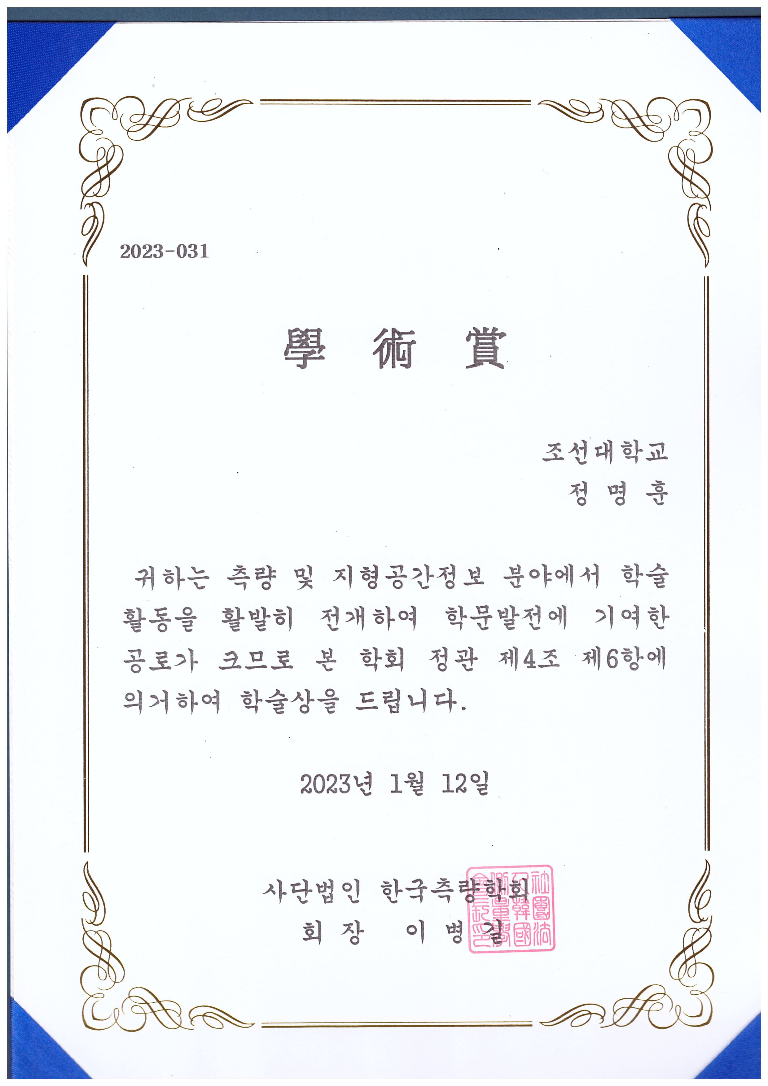
Acdemic awrad from KSGPC, 02/2023:
I received an acdemic award from Korea Society of Surveying, Geodesy, Photogrammetry, and Cartography (KSGPC).
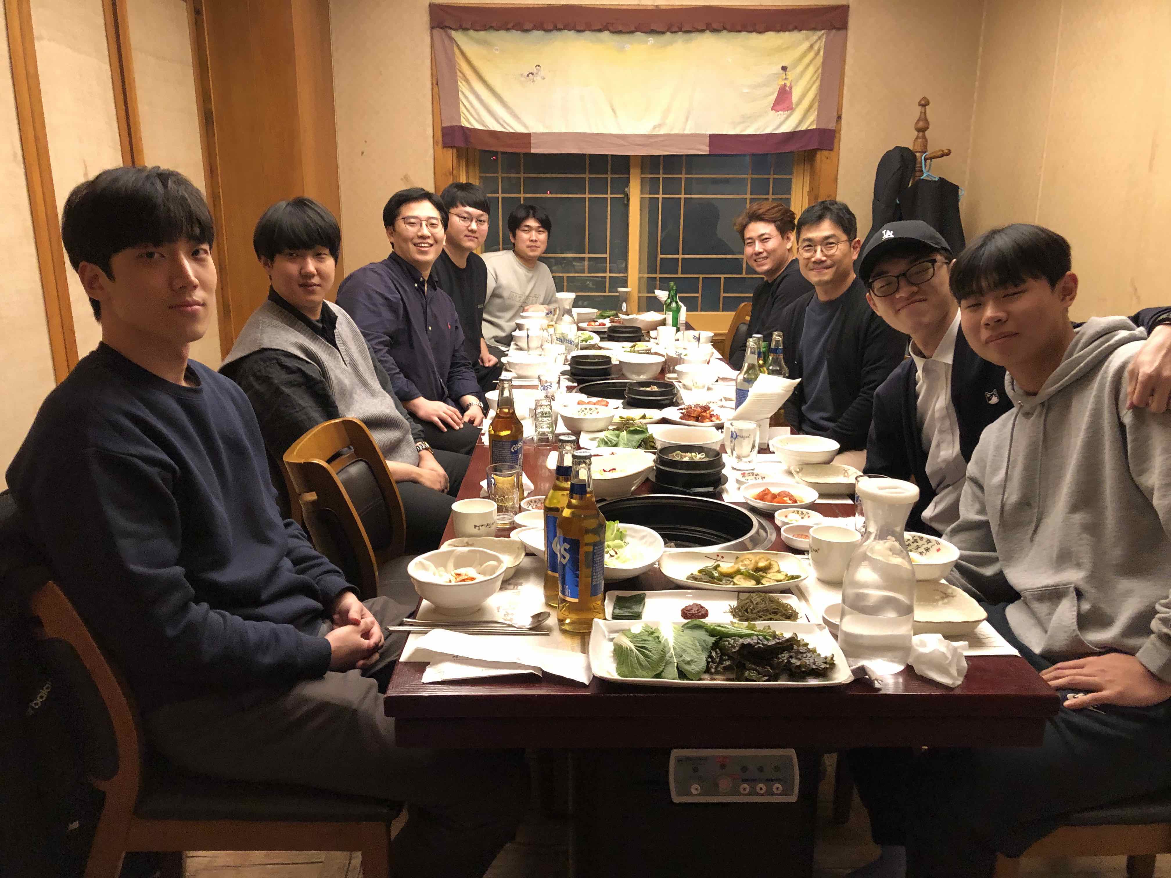
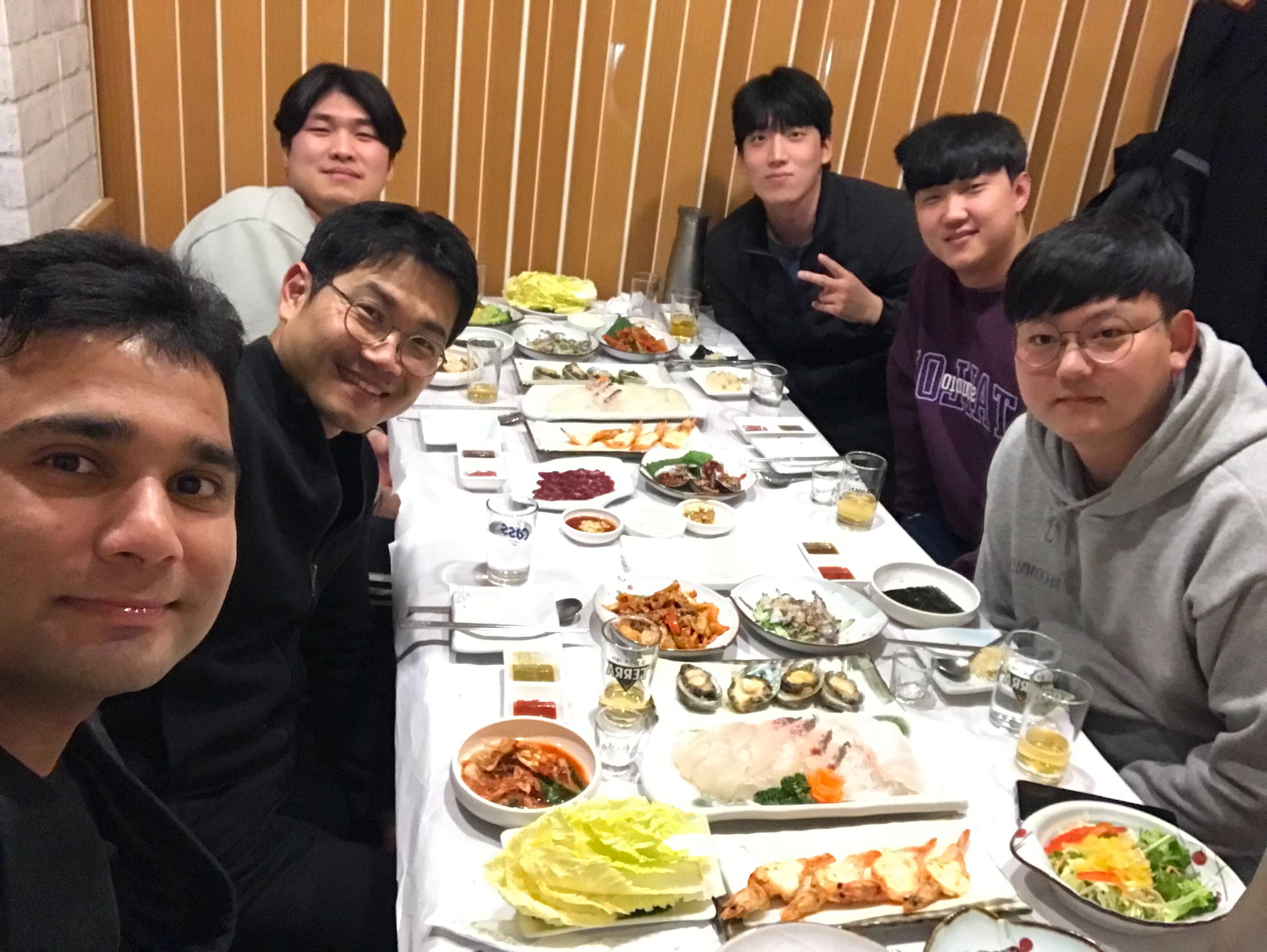
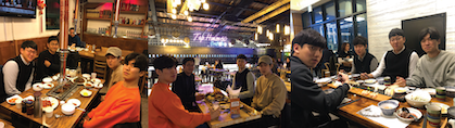
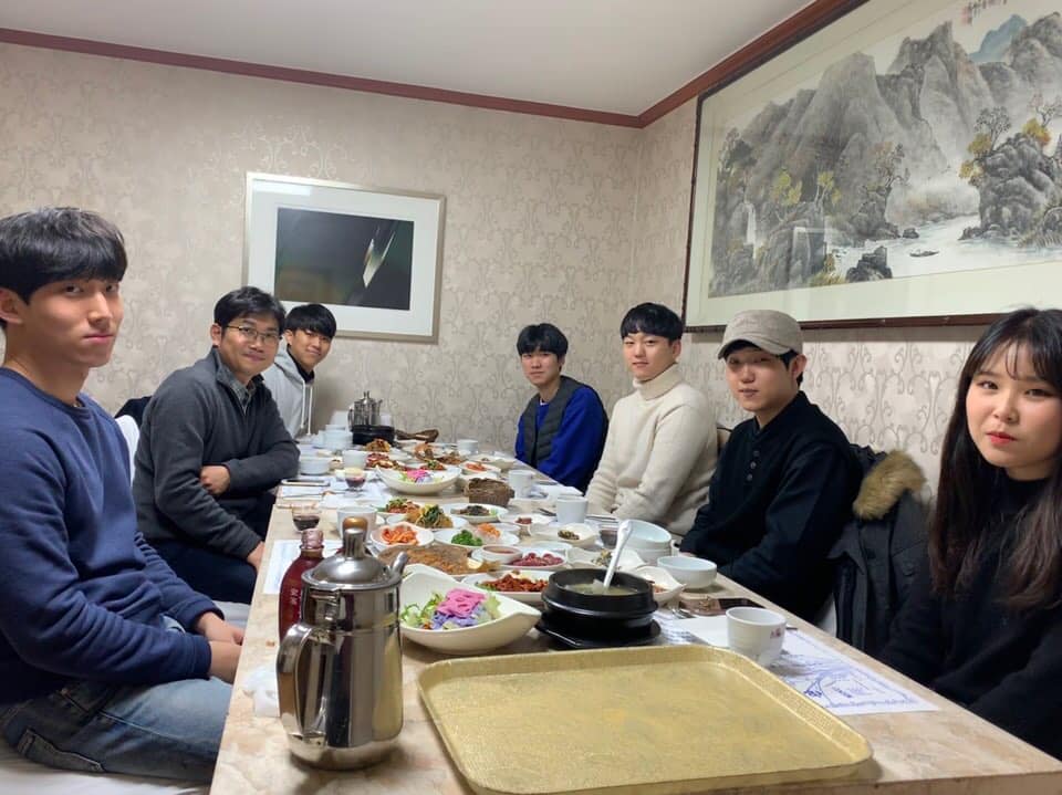
GSDS Group New Year Party, 01/2023:
Geo-Spatial Data Science Group New Year Party.
A new research grant is awarded, 12/2022: Our group is involved in new research project from the NGII for improving the national base map production.
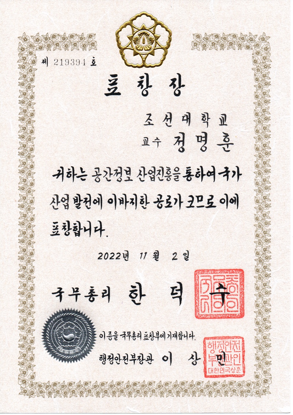
Prime Minister's Award, 11/2022:
I received a Prime Minister's Award for outstanding achievements in geospatial information research and collaboration with industry areas.
Best paper award at KSCE 2022 Convention Conference, 10/2022: Our group member, Seung-Bae Jeon, received the best paper award at KSCE 2022 Convention Conference. His research focused on predicting the traffic speed of a multi-data-based road network using spatial temporal-graph convolutional networks.
Congratulations on graduating!, 09/2022: Congratulations on graduating! Our group members, Geon Kim and Haengyoel Oh, graduated with a master's degree. Congratulations on your graduation and best wishes for your next adventure!
Participation in 12th UNGGIM as the delegate of the Republic of Korea, 08/2022:
I participated in the twelfth session of the United Nations Committee of Experts on Global Geospatial Information Management (UN-GGIM) as the delegate of the Republic of Korea. I have mainly been involved in the Working Group on Marine Geospatial Information to support Korea Hydrographic and Oceanographic Agency.
Best paper award at the 2022 KSIS conference, 06/2022:
Our group member, Geon Kim, received the best paper award at the 2022 Korea Spatial Information Society(KSIS) Spring Conference. Seungbae Jeon received the paper award from Korea Spatial Information Society Journal.
Presentation at 13th IHO MSDIWG and 3rd UNGGIM WG-MGI Meetings in Singapore, 05/2022: I presented the national report for MSDI at the 13th IHO MSDWG meeting. Further, I presented effective governance, policy, and legal frameworks and financing for integrated marine geospatial information management in Korea at the 3rd UNGGIM WG-MGI Meeting and International Seminar on United Nations Global Geospatial Information Management in Singapore.
Best paper award at the 2022 KSGPC conference, 04/2022: Our group member, Haengyoel Oh, received the best paper award at the 2022 KSGPC (Korea Society of Surveying, Geodesy, Photogrammetry, and Cartography) conference.
Special lecture on smart construction, 03/2022: A special lecture on smart construction took place for students in the Department of Civil Engineering, Chosun University. Six lecturers were invited from Hyundai E&C, GS E&C, Daewoo E&C, Taeyoun E&C, KCC E&C, and Halla Corporation. All lectures graduated from Chosun University. More than 200 students participated in the special lecture.
Dr. Sarfraz farewell party, 02/2022:
Dr. Sarfraz as a Postdoctoral scholar will move to The University of Sheffield, UK. Thank you for all your excellent work in our group, and best of luck with your future.
Journal article accepted, 01/2022: Our group member, Taeyoung Lee, published his research on Sensors and Materials. The title of this paper is Object Detection of Road Facilities Using YOLOv3 for High-definition Map Updates.
Journal article accepted, 12/2021: This paper performs gap filling using two deep learning methods (two-dimensional convolutional neural network and long short-term memory neural networks) and two machine learning models (support vector machine and random forest). We investigate their accuracies and uncertainties.
- Khan MS, Jeon SB, Jeong M-H. Gap-Filling Eddy Covariance Latent Heat Flux: Inter-Comparison of Four Machine Learning Model Predictions and Uncertainties in Forest Ecosystem. Remote Sensing. 2021; 13(24):4976.
Best Paper Award at 2021 KSGPC conference, 11/2021:
Our group member, Haengyoel Oh, received the best paper award at the 2021 KSGPC(Korea Society of
Surveying, Geodesy, Photogrammetry, and Cartography) conference.
Consolation-prize at LH COMPAS big data competition for urban problem-solving, 10/2021: Our group members (Geon Kim, Haengyoel Oh and Seungbae Jeon) received the consolation-prize at Korea Land & Housing Corporation (LH) COMPAS big data competition for urban problem-solving. They won a prize of 1.5 million won.
Promotion to Associate Professor, 09/2021: I have been promoted to Associate Professor, effective the fall 2021 semester.
Congratulations on graduating!, 08/2021:
Congratulations on graduating! Our group members, Seung-Bae Jeon and Taeyoung Lee, graduated with a master's degree. Congratulations on your graduation and best wishes for your next adventure!
National Disaster Management Research Institute grant is awarded, 07/2021: The National Disaster Management Research Institute awards a new research grant. This project aims to develop a grid-based risk analysis for disaster and safety management.
Best Paper Award and Academic Award at 2021 KSIS Spring Conference, 06/2021: Our group member, Haengyoel Oh, received the best paper award, and I received an academic award at the 2021 Korea Spatial Information Society Spring Conference.
Two master stduents' thesis defence, 05/2021:
Our group members, Seung-Bae Jeon and Taeyoung Lee, successfully defended their master's degree thesis. Seung-bae's thesis title is "Traffic Speed Prediction of Road Networks Using Deep Residual Learning Networks," and Taeyoung's thesis title is "Object Detection of Road Facilities using YOLOv3 for High Definition Map Updates."
Welcome to a new lab member, 04/2021: Welcome to Dr. Muhammad Sarfraz Khan, who joined the group as a Postdoc. He is expertise in Remote Sensing.
IHO MSDIWG and UN-GGIM WGMGI online meeting, 03/2021: I presented the national report of Korea at IHO MSDIWG online meeting. Further, I attended UN-GGIM WGMGI online meeting. KHOA supports this project.
The National Research Foundation of Korea (NRF) grant is awarded, 02/2021: A new research grant is awarded. This work is supported by the National Research Foundation of Korea (NRF) grant funded by the Korea government (Ministry of Science and ICT). This project aims to develop algorithms (e.g., road speed prediction or roadside infrastructure change detection) for smart road management using GeoAI.
The award at KSGPC 2020 Capstone Design Contest, 01/2021: Two teams from the capstone design class joined the 2020 capstone design contest by the Korean Society of Surveying, Geodesy, Photogrammetry, and Cartography. One team received the Excellence award, and the other received the Encouragement Award. Well done!
A new research grant is awarded, 12/2020: A new research grant is awarded. This research was supported by a grant (2020-MOIS31-014) of Fundamental Technology Development Program for Extreme Disaster Response funded by Ministry of Interior and Safety (MOIS, Korea).
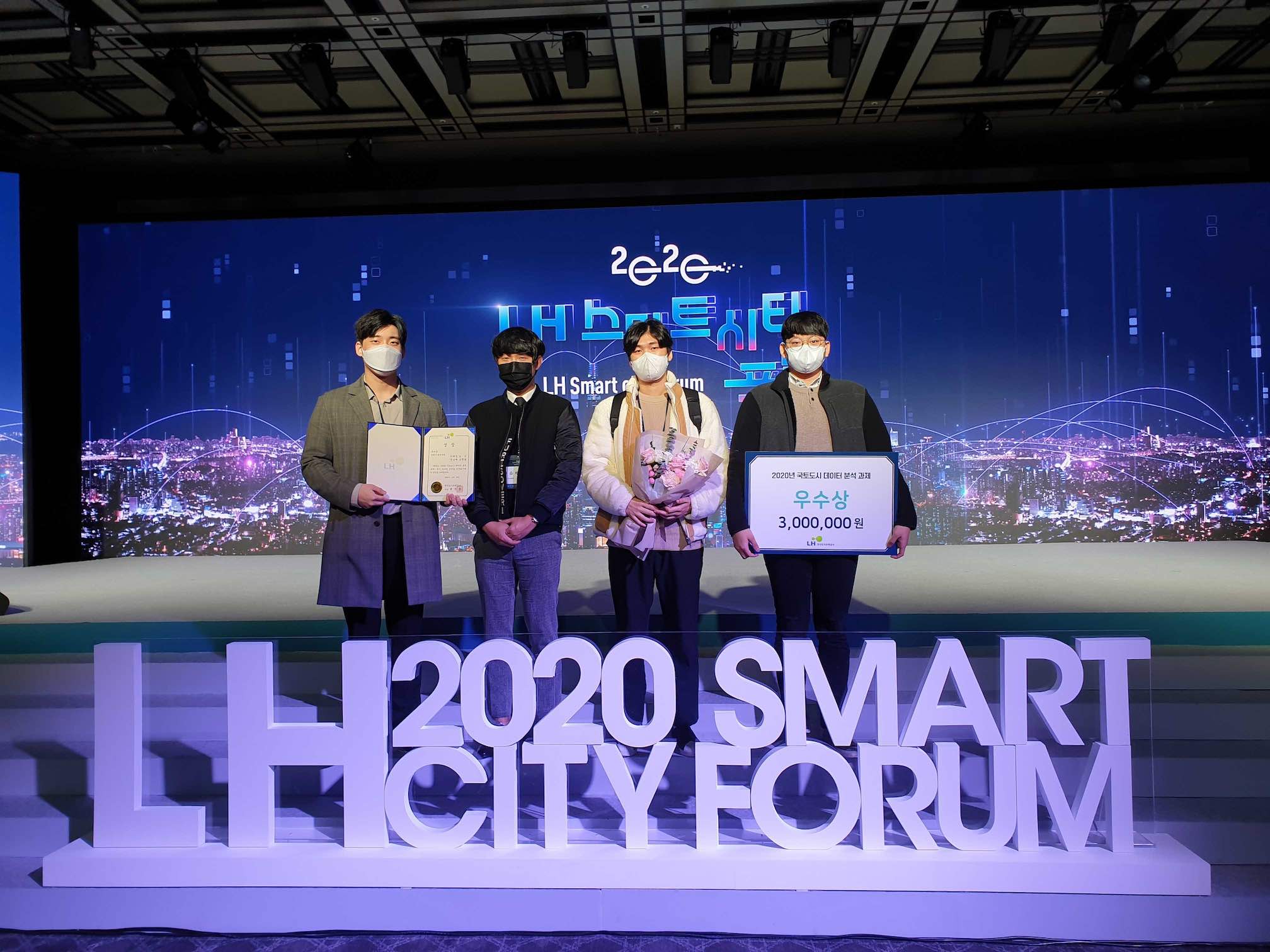
Excellence award at LH COMPAS big data competition for urban problem-solving, 11/2020:
Our group members (Taeyoung Lee, Geon Kim, Seungbae Jeon, Haengyoel Oh) received the excellence award at
Korea Land & Housing Corporation (LH) COMPAS big data competition for urban problem-solving.
They won a prize of 3 million won.
Best paper award at the KSCE convention conference and KSIS conference , 10/2020: Our group members, Seung-Bae Jeon, received the best paper award at the 2020 Korea Society of Civil Engineering Convention Conference and Taeyoung Lee also received the best paper award at the 2020 Autumn the Korea Spatial Information Society conference.
A new research grant is awarded, 09/2020: A new research grant -- Research on establishing a new strategic system for the NGII and establishing a mid- to the long-term development roadmap -- is awarded. I will be mainly involved in the life cycle management of spatial data in NGII.
Achivement award from KSGPC, 08/2020: I won an achievement award from the Korean Society of Surveying, Geodesy, Photogrammetry, and Cartography.
MOU signing ceremony between Chosun University and LH, 07/2020:
Chosun University (our group is mainly involved), and Land and Housing Corporation signed MOU.
The two organizations agreed to cooperate in discovering and carrying out joint
research tasks such as big data analytics related to urban problems, information sharing,
technology exchange, consulting, educational cooperation, nurturing human resources,
and promoting competition projects using the Urban Problem Solving Platform (COMPAS).

Best paper award at the 2020 KSIS online conference, 06/2020: Our group member, Taeyoung Lee, received the best paper award at the 2020 Korea Spatial Information Society conference. His research conducted time series clustering and outlier detection for PS-InSAR data.
LH 'COMPAS' for Spatial Analysis and Artificial Intelligence Class, 05/2020: Our class, Spatial Analysis, and Artificial Intelligence, commence using the cloud-based big data system 'COMPAS' of Land and Housing Corporation. MOU will be signed between Chosun University and LH for the collaboration of big data analytics.
Ordnance Survey consultancy phase 2 for NGII: Block C, 04/2020: Ordnance Survey consultancy phase 2 for NGII is finalized. We had the last online meeting due to COVID-19.
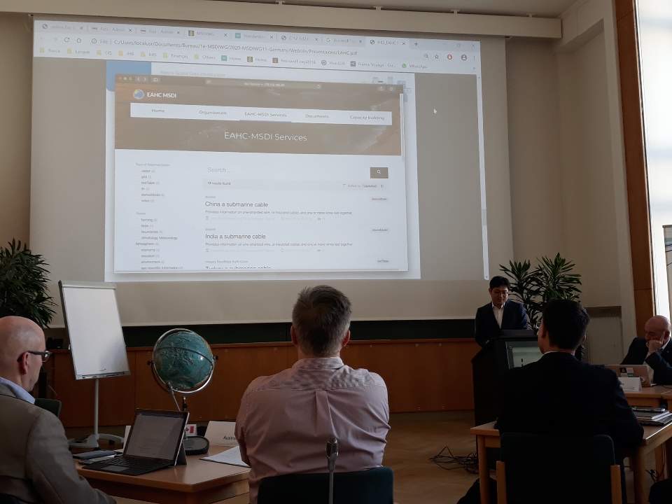
Presentation at IHO MSDIWG11 meeting, 03/2020:
I presented the status of the East Asia MSDI working group at the IHO MSDIWG11 meeting. Further,
I joined the UN-GGIM 2nd expert meeting of the working group on marine geospatial information.
Ordnance Survey consultancy phase 2 for NGII: Block B, 02/2020: Our group member, Taeyoung Lee, and I participated in the Ordnance Survey consultancy phase 2 for NGII: Block B. We discussed data model, data capture specification, and supply chain management of NGII.
GSDS Group New Year Party, 01/2020:
Geo-Spatial Data Science Group New Year Party.
Ordnance Survey consultancy phase 2 for NGII, 12/2019: I visited the headquarters of Ordnance Survey because I am currently involved in OS consultancy phase 2 for National Geographic Information Institute in Korea. I discussed a variety of topics relating to supply chain management, the data model for national base map, automatic landscape monitoring, automated feature extraction, and automated change detection.
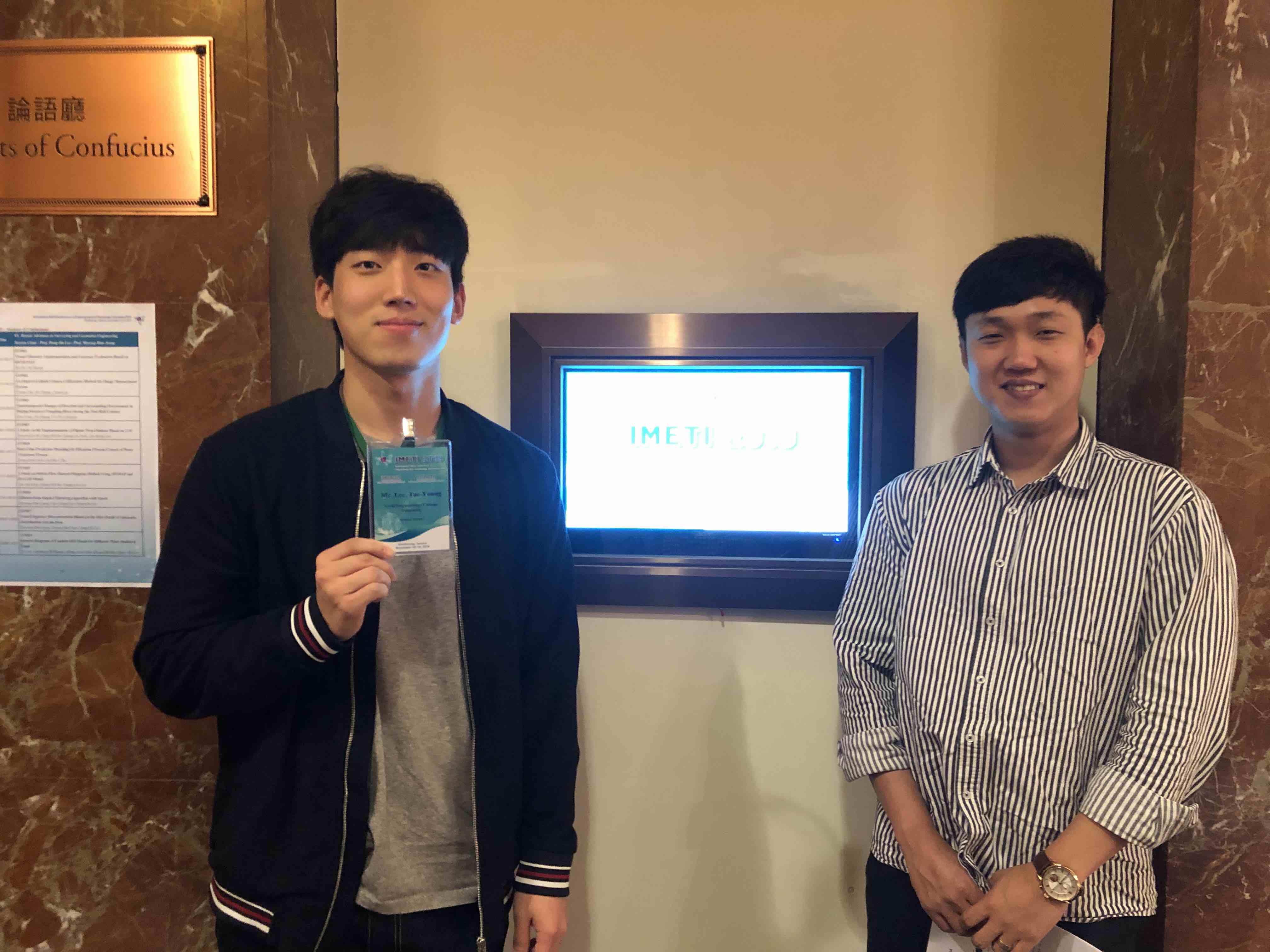
Presentation at IMETI 2019 conference, 11/2019:
Our group members, Taeyoung Lee and Seungbae Jeon, presented their research at International Multi-Conference on
Engineering and Technology Innovation 2019 conference, Kaohsiung, Taiwan.
Presentation at 2019 KSCE Conference and 2019 KSGIS Fall conference, 10/2019: Our group member, Taeyoung Lee, presented "Detection of regional demographic change due to aged population movement using spatial autocorrelation analysis" at 2019 KSCE Conference, and Haengyeol Oh presented "Vessel Trajectories Outlier Detection using Functional Data Analysis" at 2019 KSGIS Fall conference.
The new research grant is awarded, 09/2019: The new research grant -- National framework DB management + OS consultancy phase 2 -- is awarded. I am mainly involved in OS consultancy phase 2 for National Geographic Information Institute in Korea.
Participation in the 9th UN-GGIM, 08/2019:
I participated in the 9th session of the United Nations Committee of Experts on Global
Geospatial Information Management (UN-GGIM). My work is particularly related to Working
Group on Marine Geospatial Information and UN-GGIM Academic Network.
Presentation at KRISO, 07/2019: I presented my current research topics regarding the analysis of marine big geospatial data such as AIS at Korea Research Institute of Ships and Ocean engineering (KRISO).
Presentation at EAHC MSDIWG, 06/2019:
I participated in 2nd East Asia Hydrographic Commission Marine Spatial Data
Infrastructure Working Group (EAHC MSDIWG) Meeting. I presented and discussed
the direction of MSDIWG.
Best Paper Award at 2019 KSGIS conference, 05/2019: Our group member, Taeyoung Lee, received the best paper award at 2019 Korea Society for Geospatial Information Science.
Best Paper Award at 2019 KSGPC conference, 04/2019: Our group member, Seungbae Jeon, received the best paper award at 2019 Korea Society of Surveying, Geodesy, Photogrammetry, and Cartography.
Article accepted to Transactions in GIS, 03/2019: "Robust abnormality detection methods for spatial search of radioactive materials" has been accepted to Transactions in GIS. This paper proposes a robust method to detect radioactive materials in urban environments.
Ordance Survey Consultancy, 02/2019: I participated in the Ordance Survey consultancy to improve the map production process of National Geographic Information Institute in Korea.
Group New Year's Meeting, 01/2019:
Happy New Year! Spatial Data Science Group has a New Year's Meeting.
Two research grants are awarded, 12/2018: Two research grants are awarded by Korea Land and Gospatial Informatix Corporation, and National Geographic Information Institute.
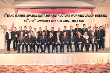
Presentation at EAHC MSDIWG, 11/2018:
I participated in 1st East Asia Hydrographic Commission Marine Spatial Data
Infrastructure (MSDI) Working Group Meeting and presented the concept and
importance of MSDI.
Presentation at 2018 Joint Fall Conference and KSCE 2018 Conference, 10/2018: Two undergraduate research assistant (Lee, Taeyoung and Jeon, Seungbae) presented our research at 2018 Joint Fall Conference and KSCE 2018 Conference. The paper at 2018 Joint Fall Conference received best paper award.
Presentation at GIScience 2018 conference, 09/2018:
The 10th International Conference on Geographic Information Science took place in Melbourne, Australia.
In understanding urban activity and mobility session, I presented our work for detecting
Origin-Destination flows outliers and conducting hypothesis testing between two
OD flow datasets with New York Taxi data.
The Ministry of SMEs and Startups (MSS, Korea) grant award, 08/2018: Open source-based spatial data analysis platform and web mapping SaaS development. Funded by: The Ministry of SMEs and Startups (MSS, Korea) (2018--2019).
Article accepted to Mobile Networks and Applications, 07/2018: "LaSa: Location Aware Wireless Security Access Control for IoT Systems" has been accepted to Mobile Networks and Applications. The first author is Bingxian Lu, who was my mentee in spatiotemporal research theme at CyberGIS center, UIUC.
Presentation at IWSS 2018 conference, 06/2018: I presented two abstracts at the 3rd International Water Safety Symposium in South Korea.
GIScience 2018 paper is accepted, 05/2018: "Outliers Detection and Comparison of Origin-Destination Flows with Data Depth" has been accepted as a full paper to the prestigious GIScience 2018 conference. This paper proposes a new data depth based outliers detection and comparisons of OD flows.
Presentation at KSSGPC conference, 04/2018: I presented an article (Robust statistics 기법을 이용한 대용량 공간 데이터 밀도 맵 향상에 관한 연구) at 2018 Korea Society of Surveying, Geodesy, Photogrammetry and Cartography conference.
National Research Foundation of Korea(NRF) grant award, 03/2018: Development of geospatial big data algorithm for massive movement data analysis. Funded by: National Research Foundation of Korea (NRF) (2018--2020).
Best Paper Award at GISUP and KOGSIS Conference, 02/2018: A paper, "Detecting taxi trajectory anomalies between regions of interest", received best paper award at Joint International Symposium of GISUP and KOGSIS in Korea.
Article accepted to International Journal of Geographical Information Science, 01/2018: "A multidimensional spatial scan statistics approach to movement pattern comparison" was accepted to International Journal of Geographical Information Science. The first author is Yizhao Gao, who was my mentee in spatiotemporal research theme at CyberGIS center, UIUC.
Two articles accepted to domestic journals, 12/2017: Two articles have been accepted to domestic journals: The Korean Society for Geo-Spatial Information Sicence, and Korean Society of Hazard Mitigation.
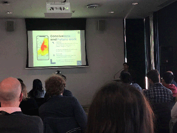
Presentation at two conferences in Korean, 11/2017: I presented two conference articles at KSCE 2018 convention, and KSIS fall conference.
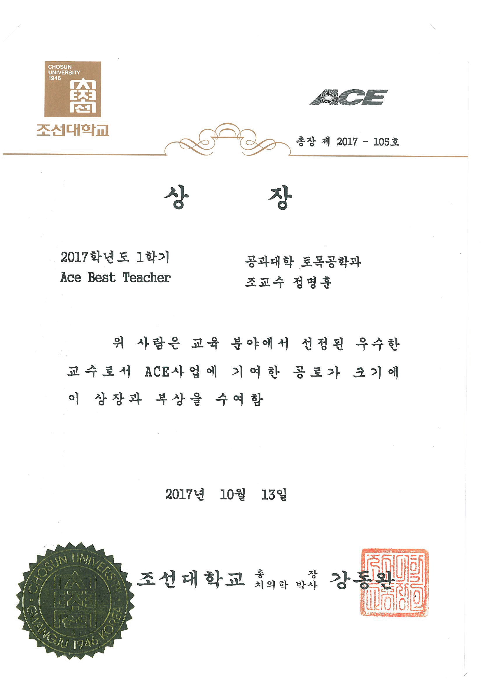
2017 Spring Semester ACE Best Teacher Award, 10/2017:
I am delighted to have received ACE Best Teacher Award in recognition of my work during last semester.
KOICA Global Training, 09/2017: I participated in a workshop as an instructor for Capacity Building For Surveying and Geographic Information Institute. Twenty representatives from eight countries (e.g., Nepal, Mozambique, Mongolia, Uzbekistan, Vietnam, Nicaragua, Philippines, and Rwanda) joined this worksop.
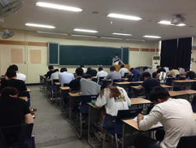
Spring semester ends, 06/2017: I taught three courses -- Fundamentals of GIS, Surveying I,
and Capstone Design -- in the spring at Chosun University.
The figure shows the final test for Fundamentals of GIS. Well done everyone.
New position as an Assistant Professor, 03/2017: I embark on a new journey of my life as an Assistant Professor in the Department of Civil Engineering, Chosun University, Korea.
Instructor, GEOG 489 (Programming for GIS), 01/2017: I led GEOG 489 (Programming for GIS) course, Spring 2017 in the Illinois at Urbana-Champaign Department of Geography and Geographic Information Science. Topics include the principles of programming, advanced function and tools coding, visualization, fundamental spatial data structures, and spatial algorithms
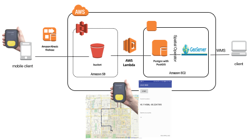
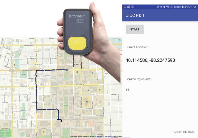
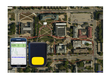
Android app with AWS Kinesis, 12/2016: I am developing an android app with AWS Kinesis.
The aim of this work is for streaming data analysis of radiation levels.
Teaching at CyberGIS Fall Training Workshops, 11/2016: I taught how to use R on ROGER, CyberGIS Fall Training Workshops. This workshop provided how to use parallel processing for R in geospatial applications by using Jupyter Notebook.
Presentation at ACM SIGSPATIAL, 10/2016: I presented a paper "Data depth based clustering analysis" at ACM SIGSPATIAL 2016 [ppt]. The accept rate was 18% (40 out of 217) this year.
ACM GIS paper is accepted, 09/2016: Data depth based clustering analysis was accepted as a full paper to ACM SIGSPATIAL 2016. This paper proposes a new data depth based clustering method which can preserve clusters under affine transformations.
- M.-H. Jeong, Y. Cai, C. J. Sullivan, and S. Wang. Data depth based clustering analysis. In Proc. of 24th ACM SIGSPATIAL International Conference on Geographic Information Systems, California, USA, accepted 2016.
Presentation at CyberGIS 2016, 08/2016: This work proposes a hypothesis testing of two spatiotemporal patterns using data depth. Data depth based inference takes into account the overall structure of the data to detect differences in the amount of scale and shifts in location.
Teaching at CyberGIS Summer School, 07/2016: I taught how to use R for big spatial data analysis on ROGER, CyberGIS Summer School. This workshop provides how to leverage parallel processing in R, and how to connect R up to Hadoop.
Three short peer-reviewed papers are accepted, 06/2016: I have had three short peer-reviewed conference papers accepted in quick succession.
- M.-H. Jeong, J. Yin, C. J. Sullivan, and S. Wang. Robust statistical approaches to enhance spatial autocorrelation. In Proc. of 9th International Conference on Geographic Information Science, Canada, accepted 2016.
- M.-H. Jeong, C. J. Sullivan, and S. Wang. Minimization of the impact of sensor velocity on the probability of source detection using geographically weighted methods. In Proc. IEEE Nuclear Science Symposium & Medical Imaging Conference, France, accepted 2016.
- M.-H. Jeong, S. Wang, and C. J. Sullivan. Density maps based on data depth. In Proc. of 3rd International Conference on CyberGIS and Geospatial Data Science, USA, accepted 2016.
Android app development for streaming data analysis, 05/2016:
I made an android app with AWS kinesis to load and analyze streaming data. This app will be used for radiation data analysis in real time.
Presentation at AAG 2016, 04/2016: I gave a short presentation at Association of American Geographers Annual Meeting: Robust cluster analysis using data depth. This approach is affine equivalence and robust to noises.
Teaching at Advanced Topics in GIS (GEOG 479), 03/2016: I taught big data analysis with R in the course of Advanced Topics in GIS (GEOG 479). This sub-course deals with the fundamentals of parallel R computation as well as Hadoop with R to have a better undersanding of big spatial data sets.
A full peer-reviewed conference paper submission, 02/2016: This paper describes spatial analyses as a manner that includes new insights and advances that are often ignored in a standard geospatial analysis. The approach is based on the robust statistics methods. This study presents how and why conventional geospatial analysis can be unsatisfactory under non-normal distributions with practical and simulated data. Further, the revised approaches show insensitivity against deviations from the assumptions.
- M.-H. Jeong, J. Yin, C. J. Sullivan and S. Wang. Robust statistical approaches to enhance spatial autorcorrelation and density estimation. in review
A short conference paper submission, 01/2016: This article presents a broad range of geospatial methods for radioactive source detection.
- M.-H. Jeong, C. J. Sullivan and S. Wang. Urban search of radioactive materials enhanced by mobile sensor networks and geospatial methods. in review
Experiments for anomaly detection of radiation levels, 12/2015: The aim of this work is higher probability of detection with lower false alarm rate with mobile sensors. I am currently using local spatial association to identify radiation abnormality.
Teaching at CyberGIS Fall Workshops, 11/2015: I lead two workshops: Data Parallelism for GIS Analysis, and Data Science with Pig on Hadoop. These workshops provide hands-on training with cutting-edge CyberGIS applications with a focus on big data handing and analysis.
Journal article accepted, 10/2015: This research investigates the graphical representation of uncertain numerical data (such as the outputs from predictive epidemiological models) that makes relative (qualitative) judgments as effortless as possible, while making absolute (quantitative) estimation as effortful as possible.
- Jeong M-H, Duckham M, Bleisch S (2015) Graphical Aids to the Estimation and Discrimination of Uncertain Numerical Data. PLoS ONE 10(10): e0141271.
Presentation at 2015 CyberGIS All Hands Meeting, 09/2015: I introduced my current project "Detection of the Illicit Movement of Nuclear Materials with Big Data" at CyberGIS AHM'15.
Journal article accepted, 08/2015: This paper describes an efficient, decentralized algorithm in a geosensor network to monitor qualitative spatial events in a dynamic scalar field. The events of interest involve changes to the critical points (i.e., peak, pits and passes) and edges of the surface network derived from the field.
- Jeong, M.-H. and Duckham, M. Decentralized Detection of Qualitative Spatial Events in a Dynamic Scalar Field. Sensors, 15:21350-21376, 2015
Teaching at CyberGIS Summer School on Big Data Landscapes, 07/2015: I led Data Science with Python on Hadoop workshop. This workshop is primarily designed for researchers who need to understand how to apply data science to large datasets with Hadoop.
Presentation at Vespucci 2015, 06/2015:
I presented my paper [presentation file] at GIScience 2015 Vespucci Institute. It was a good oppoortunity to meet big and young stars at GIScience discipline.
Conference article accepted, 05/2015: This article provides an alternative to understand radiation level changes using surface networks.
- M.-H. Jeong, S. Wang and C. J. Sullivan (2015) Analysis of dynamic radiation level changes using surface networks. Accepted for Advancing Geographic Information Science: The Past and Next Twenty Years, 2015, Maine, USA.
Presentation at AAG 2015, 04/2015: I gave a short presentation at Association of American Geographers Annual Meeting. I explained the detection of radiation level changes using geovisualization and geographic information systems.
Nuclear forensics with GIS, 02/2015: I have involded in a new project, Nuclear forensics driven by geographic information system and big data analytics. I visualized radiation measurements in July 2013, Koriyama Japan. The data was acquired from Safecast (http://blog.safecast.org).
New position as a postdoctoral research associate, 10/2014: I have joined in CyberGIS center as a postdoctoral research associate. I will mainly work on spatial algorithm to deal with unprecedented large data sets.
Presentation at ARC Linkage Project update meeting: 08/2014: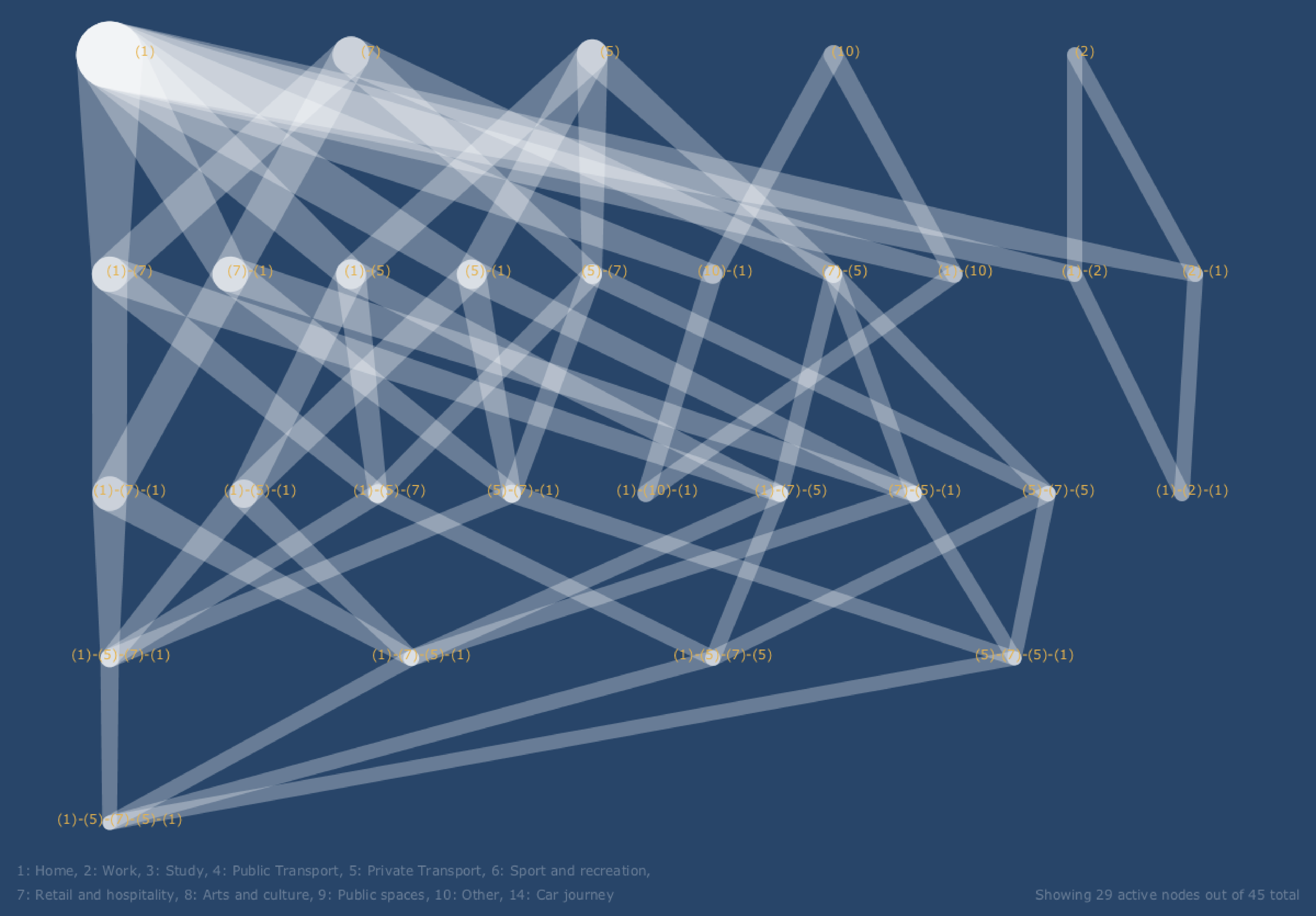 "Networks, neighborhoods and newborns: defining household and local area influences on social connectedness, to understand pathways to health"
I presented preliminary findings at this meeting. People trajectories are generated based on CATI data. Frequent patterns of location use (e.g., house - work - house) are discovered using people trajectories. The discovered frequent sequences revealed how the individual trajectories differ across advantaged and disadvantaged areas. The linked image visualizes the frequent sequences of advantaged areas by using hierarchical layered graphs.
"Networks, neighborhoods and newborns: defining household and local area influences on social connectedness, to understand pathways to health"
I presented preliminary findings at this meeting. People trajectories are generated based on CATI data. Frequent patterns of location use (e.g., house - work - house) are discovered using people trajectories. The discovered frequent sequences revealed how the individual trajectories differ across advantaged and disadvantaged areas. The linked image visualizes the frequent sequences of advantaged areas by using hierarchical layered graphs.
Pilot experiment for communicating complexity and uncertainty, 07/2014:
 The pilot experiment was conducted with volunteer students in Spatial Visualization class. The aim of this experiment is to enable policy makers to make informed and effective decisions using visualization. Mathematical models are increasingly used to help policy makers to decide alternative strategies in terms of infectious disease health policy. However, modelling approaches are challenging to communicate accurately and comprehensibly. This experiment provided non-numeric displays to the participants in order to avoid communicating with uncertain explicit quantities.
PhD degree award, 06/2014: I have sucessfully completed all the requirements for the PhD degree. My thesis examiners were Associate Professor Nittel Silvia at University of Maine and Professor Monika Sester at University Hannover. The citation is "Who studied the foundations of spatial computing in highly distributed environmental sensor systems, like wireless geosensor networks. His results show how decentralized algorithms can be used efficiently to monitor the qualitative characteristics of spatiotemporal fields. His work will help us to make sense of big data from environmental sensor systems."
- M.-H. Jeong. Qualitative characteristics of fields monitored by a resource-constrained geosensor network. Ph.D. dissertation, University of Melbourne, 2014.
New position as a research fellow (PostDoc), 02/2014: I have joined Sense+Know project as a postdoctoral research fellow after I submitted my thesis ("Qualitative characteristics of fields monitored by a resource-constrained geosensor network").
Journal article accepted, 04/2013: This paper provides a decentralized and coordinate-free algorithm, called DGraF (decentralized gradient field) to identify critical points (peaks, pits, and passes) and the topological structure of the surface network connecting those critical points.
- Jeong, M.-H., Duckham, M., Kealy, A., Miller, H., and Peisker, A. (Accepted) Decentralized and coordinate-free computation of critical points and surface networks in a discretized scalar field. International Journal of Geographical Information Science
Journal article accepted, 12/2012: This paper explores the design and evalutation of a family of new algorithms for determining the topological relations between regions monitored by such a resoruce-constrained geosensor network. The algorithms are based on efficient decentralized (in-network) variants of conventional 4-intersection and intersection and difference models, with in-network data aggregation.
- Jeong, M.-H. and Duckham, M. (Accepted) Decentralized querying of topological relations between regions monitored by a coordinate-free geosensor network. Geoinformatica
Conference article accepted, 12/2012: This article proposes a decentralized and coordinate-free algorithm to monitor spatial events in a dynamic scalar field. The events that are the focus of this article are the appearance, disappearance and movement of "peaks" (local maxima).
- Jeong, M.-H. and Duckham, M. (2013) A coordinate-free, decentralized algorithm for monitoring events occurring to peaks in a dynamic scalar field. Accepted for ISSNIP 2013, Melbourne, Australia.